Strong, severe storms possible later today
Published 8:49 am Wednesday, March 11, 2020
Severe weather is possible as forecasters watch a mass of thunderstorms that will roll from the Missouri and Arkansas into Alabama this afternoon.
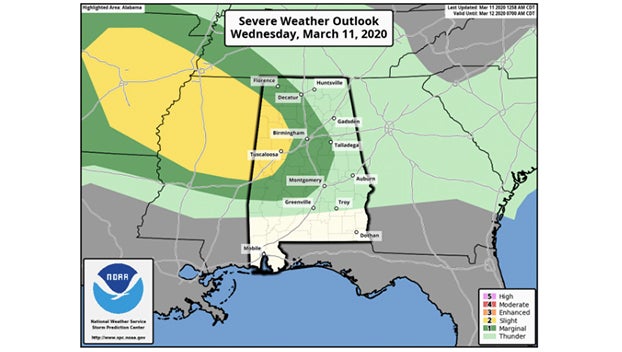
The National Weather Service has issued a weather advisory for parts of the state. Parts of West Alabama, including Tuscaloosa, Hamilton, Fayette, Vernon, Reform, Eutaw, and Livingston, will see a “slight risk” for severe weather. The strongest storms could have winds up to 60 mph and hail up to 1 inch in diameter. The tornado threat is on the low side with today’s storms, according to the weather service.
A “marginal risk” extends as far east as Oneonta, Pell City, Rockford, and Prattville.
Storms could enter Northwest Alabama as early as 1 p.m. today. They reach Cullman, Birmingham and Tuscaloosa by 4 p.m. then moving into east Alabama after 6 p.m.
Rain amounts should be 1/2 inch or less for most places. Flooding is not expected.
Prior to the arrival of the thunderstorms, the day will be mostly cloudy and mild with a high in the low to mid-70s this afternoon.