Alabama Skies Bulletin: Parts of the state upgraded to Level 3 severe risk
Published 7:53 pm Monday, January 23, 2023
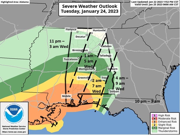
Parts of Alabama are facing a Level 3 out of 5 severe weather risk overnight Tuesday into early Wednesday morning. Even in areas not expecting severe weather, winds could gust up to 60 miles per hour.
The Storm Prediction Center is expecting a very strong cold front to make its way through overnight Tuesday, sparking strong storms across the state with the worst storms in southern Alabama.
The Level 3 risk area includes likely tornadoes, winds up to 70 miles per hour, and large hail. Some cities in the risk area include Mobile, Gulf Shores, Foley, Jackson, and Thomasville.
A Level 2 risk area circles the Level 3 and includes Butler, Greenville, and Andalusa. People in this risk level can expect possible tornadoes, damaging winds up to70 miles per hour, and large hail.
The larger Level 1 risk area includes Montgomery, Tuscaloosa, Birmingham, Auburn, Troy, and Dothan. This area could experience an isolated tornado, large hail, and damaging wind gusts.
Right now, forecasters expect storms to move into the area around 1 a.m. and leave the state around 7 a.m.
We will have the latest details and timing Tuesday morning.


